
Our Articles
Why Models from Point Cloud Data are Useful for Architectural and MEP Design
Construction, much like other industries across the globe, must face a new world order – one that takes climate change, green building and the mantra of reduce, reuse, recycle into consideration. Renovation of existing buildings is one example of how a building can be reused for a different purpose. Refurbishment and renovation projects in the AEC industry typically involve old buildings, where modifications in the architecture, structure and MEP systems in the building are typically not recorded or updated for years. During a refurbishment project, the extent of the renovation depends on whether the building is completely stripped or if some of the existing MEP elements are used. A key requirement for such a project is an accurate as-built model with architectural, structural and MEP element detailing. Precise architectural 3D modelling and an accurate depiction of existing MEP services is essential. Using Building Information Modelling, or BIM, technology has made this task easier, especially with the contribution of experienced and reliable MEP BIM services.
One way to capture the as-built conditions of a building is to re-create the model using point cloud data and then model it. Point cloud modelling involves 3D scanning with high-end laser scanners, which measure and map millions of points of building objects and surfaces. Compared to a manual survey, point cloud data models are more accurate and provide more certainty. So, this brings us to the concept of Scan to BIM.

The term Scan to BIM is essentially defined as the practice or process of creating a digital 3D model of an existing building’s physical and functional features in a BIM environment. A laser scanner captures point-cloud data, which can be developed using 3D BIM software, such as Autodesk’s Revit, Graphisoft’s ArchiCAD, Vectorworks, etc. This results in the development of accurate as-built models with actual conditions.
The process of Scan to BIM begins with the requirements of the models or drawings. The model’s level of detail (LOD) must be identified, as higher modelling accuracy increases the as-built model’s reliability. The catch is that for a higher level of detail, there is a higher cost. So, data density and affordability must be considered at this point. At this point, the following requirements are determined:
Next, parameters must be set before the 3D scan gets under way. The significance of this step comes into play when existing design documentation for the building may not be easy to locate. All the necessary attributes for scanning must be identified. Some of the parameters to consider are:
So, how is a point cloud data model created?
During the process of laser scanning, 360-degree photometric images are created to identify objects not distinguishable in the point cloud data. The scanned point cloud data and the photometric images are sent to 3D modellers, who can build 3D architectural and MEP elements of the building. To enable the successful conversion of point cloud data to a 3D model, the following requirements are considered:
Point Cloud Data
Laser scan – A 3D laser scan needs to be conducted of the existing building. Sometimes, as-built drawings are not reliable, so laser scans are used with high speed and precision to provide the depth required by modellers to create a 3D model. Typically, the laser scan, using scanning tools from Faro, Riegl, Trimble, Leica, etc., will involve an eye-safe laser rotating at high speed placed on a tripod. Wherever the laser beam hits a solid surface, the location is recorded as ‘points’ with coordinates. Groups of points are mapped together to create a digital image. When all the points are recorded, the scanner colourises it and thus develops a 3D map of the site with a variety of viewpoints, which is called a point cloud scan.
Both exteriors and interiors are captured in the scan, including concealed MEP installations. Then the scanned data can be used to generate a 3D model with Revit software. For MEP elements, laser scans must be accurate to ensure the retrofitting of additional MEP systems and elements that ensure a clash-free model.
3D photography – With laser scans, 360-degree photometric images must be photographed to provide architectural modellers and MEP (M&E) design consultants with an understanding of the objects in the building environment.
Other scanning processes include:
Time-of-Flight Scans – measuring the distance between the horizontal and vertical angles for every position.
Phase-based Scans – measuring the phase shift of the returning laser energy to calculate distances.
Level of Detail (LOD)
Depending on the project requirements, the LOD must be specified to allow scanning professionals to understand the extent to which a scan must be conducted. If MEP elements should be retrofitted, a precise laser scan with detailed point cloud data is required.
Tolerance Levels
In 3D architectural modelling, when MEP elements from a point cloud model are extracted, there is an extent to which corrections can be made. Tolerance limits and camera angles must be decided by the architect or scanning professional at the outset of the project before the laser scan takes place. Tolerance levels provide modellers with leeway when designing 3D architectural and MEP models from point cloud data.
As models generated through point clouds require a high degree of accuracy, it is important to utilise the right tools to generate these models. Using Revit for the Scan to BIM exercise presents a few advantages.
To develop 3D architectural modelling and MEP modelling from point cloud scans, it is important to be accurate, experienced and have an understanding of the spatial relationships of structural elements in a building.
New software programs enable data from models to be exported to several mainstream CAD platforms after performing clash detection. There are ‘smart point cloud’ and ‘point cloud to BIM’ software programs that can convert a laser scan of point cloud data into 3D BIM models. By utilising these new software tools, one can develop accurate, installation-ready and clash-free models. For precise architectural 3D modelling and reliable MEP services, it is essential to find an experienced partner who can deliver these services on time and within budget. Thus, point cloud data models can have a significant positive impact on architectural and MEP design.
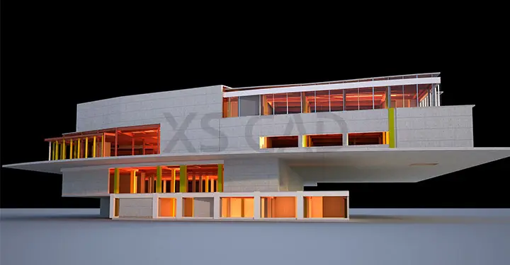
At XS CAD, our scan to BIM service provides accurate models for as-built purposes and for retrofit, refurbishment and renovation projects. We use raw survey data and images from tools such as Leica Geosystems or from other laser survey tools and a range of specialist software tools, including CloudWorx, to create accurate architectural 3D modelling and MEP BIM services for existing buildings. Our experienced team of BIM modellers, BIM coordinators and MEP designers have extensive design experience using the latest AEC technology.